|
|
Challenging the Wisdom of the Trans Texas Corridor.
|

| Trans Texas Corridor | |||
|---|---|---|---|
|
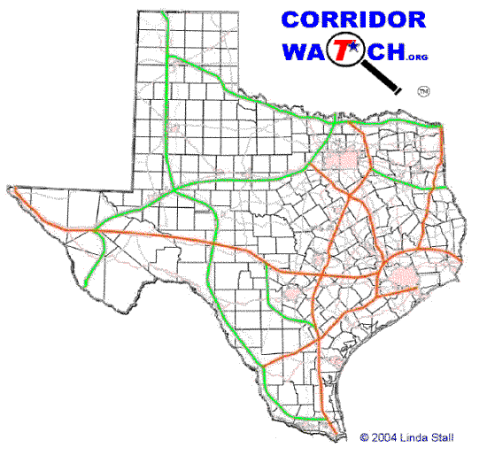
TxDOT's 2002 Corridor Conceptual Map |
June 2002 Conceptual Corridor Plan
The green and orange lines shown on these maps are new corridor highways, not existing highways. The orange routes are the Priority Corridors. This map showing county boundaries was produced by CorridorWatch.org from Conceptual Map found in the Crossroads of the Americas: The Trans Texas Corridor Plan. |
||
This Page Last Updated: Tuesday January 09, 2007